Ground and aerial surveying: How drones support large infrastructure projects
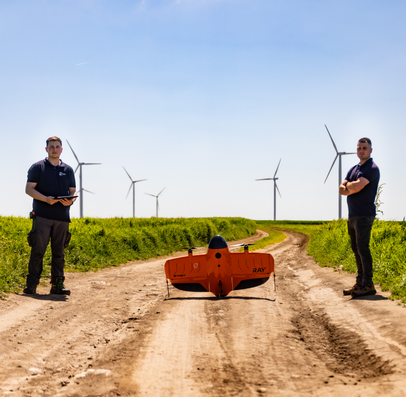
Infrastructure projects generate a massive amount of information from the earliest stages of development. Discrepancies between site conditions and documentation, construction delays, or design errors often stem from the way initial data is collected. For this reason, technologies such as 3D laser scanning, photogrammetry, and aerial mapping are increasingly being integrated into complex infrastructure projects, […]
Orthophotoplan: What is it and how can it help you?

What is an Orthophotoplan? An orthophotoplan is a metric image created by combining aerial photographs taken by a drone. Unlike a simple stitching of photographs, the orthophotoplan eliminates distortions caused by the photogrammetric camera or the terrain’s relief. It is generated within a well-defined projection system, such as Romania’s national Stereo ’70 projection system. Below, […]
The use of AI technology in 3D scanning and modeling
3D laser scanning technology, combined with artificial intelligence (AI), is transforming the way we collect and analyze three-dimensional data. From architecture and construction to cultural heritage preservation and environmental studies, the applications and benefits are numerous and diverse. As technology advances, the integration of AI will continue to enhance the efficiency, precision, and versatility of […]