

The fastest and most accurate way to measure.
Complete information about your building or construction with a single scanning session — point cloud, 3D models, 2D plans and Scan-to-BIM.
3D laser scanning for construction projects
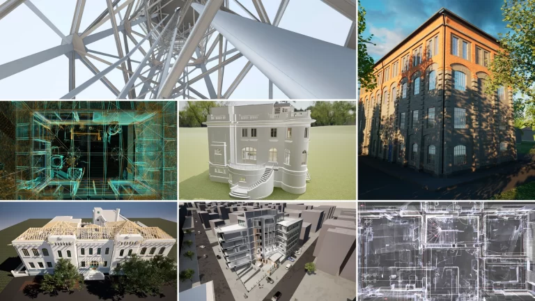
Benefits of 3D laser scanning
- High speed of data acquisition
- recording millions of measured points in a few seconds
- maximizing safety for everyone involved (data is collected from a safe distance)
- significant reduction in time and costs
- Real image of the project
- detailed information contained in a single point cloud
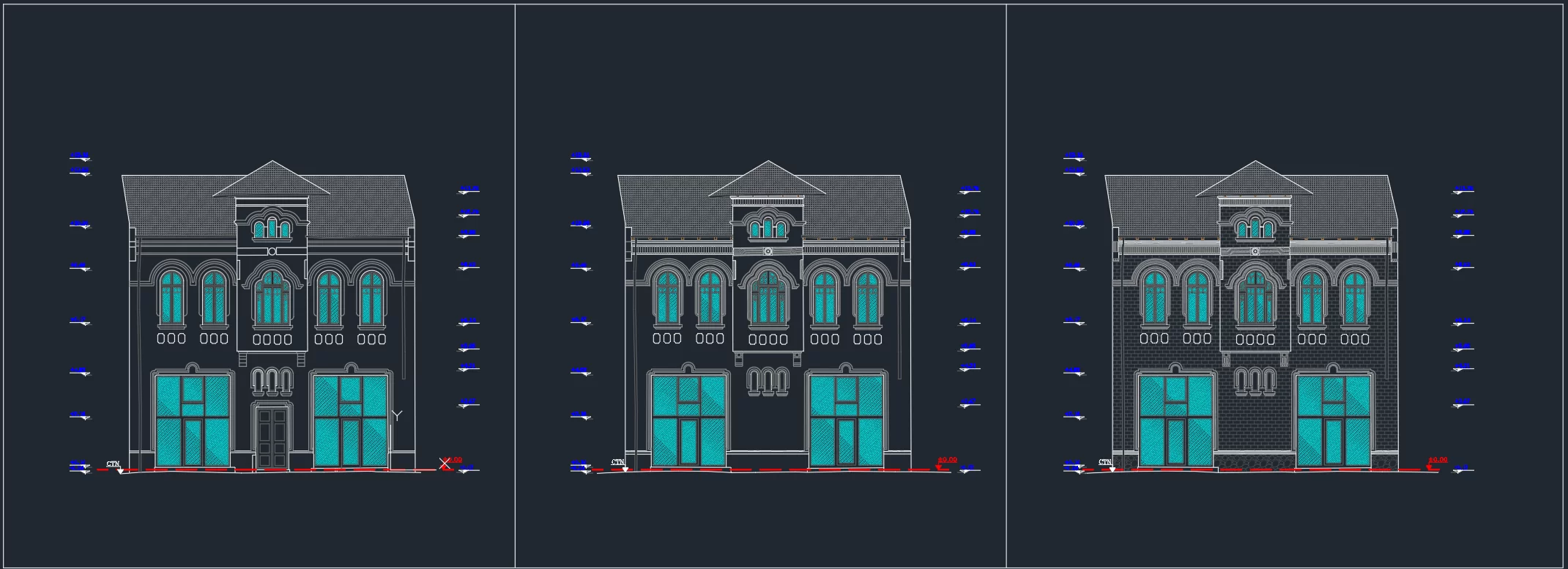
The point cloud resulting from the 3D scanning process is processed to generate a broad and detailed image of the project through 3️D models and complex 2️D drawings, provided according to the level of detail chosen by the beneficiary – LOD 100, 200, 300.
This process accurately determines the surfaces of objects or buildings, as well as degraded areas, the geometry, position, thickness and verticality of existing walls, being useful in creating: surveys, cross-sections, facades, 3D models of buildings or digital terrain models (DTM).
3D laser scanning plays an essential role in the modernization and automation of the workflow and process in the construction field and beyond.
We use 4 terrestrial 3D laser scanning equipment:
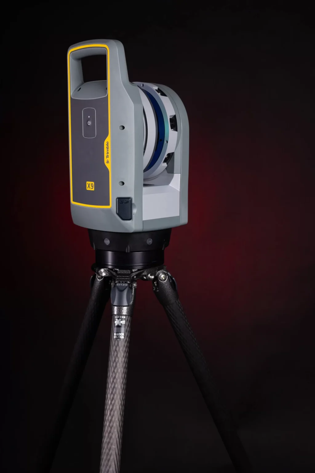
- Impressive speed – up to 1 million points per second
- Data acquisition distance up to 150m
- Increased work speed due to the self-registration process carried out in the field.
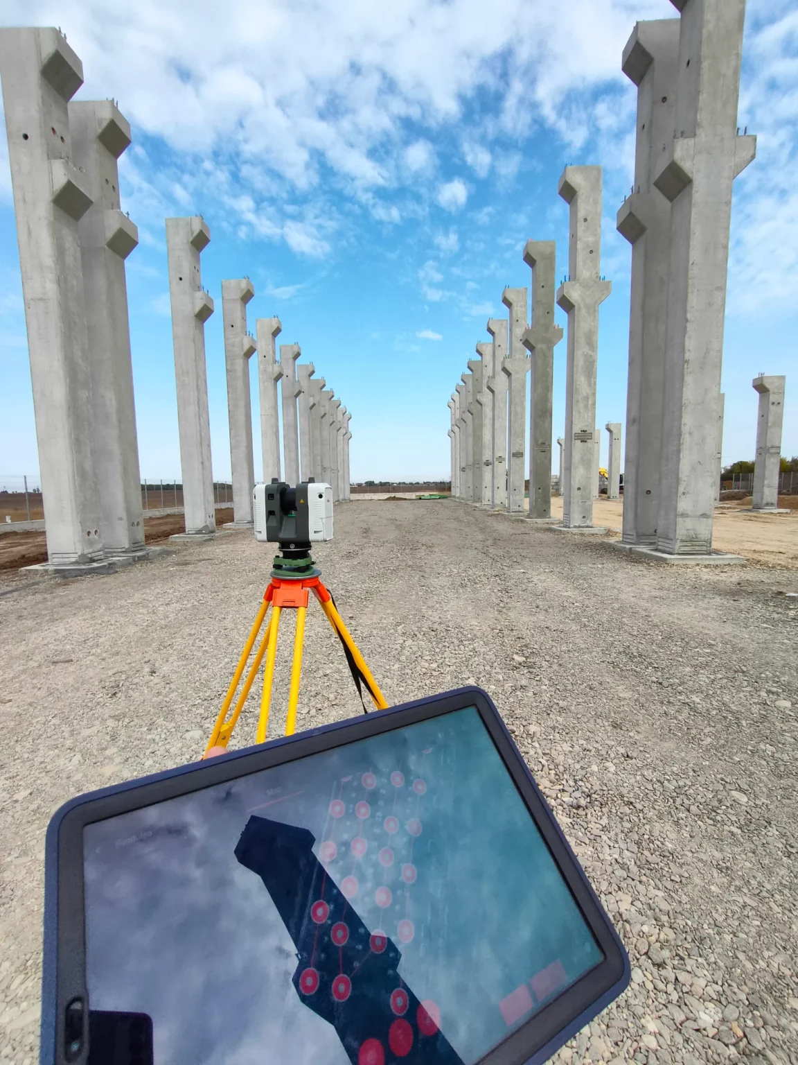
- The world's fastest laser scanner, up to 2 million points per second
- The only equipment in the world equipped with VIS positioning system (for indoor use)
- Equipment capable of capturing a 360 panorama with 5 HDR exposures in one minute.
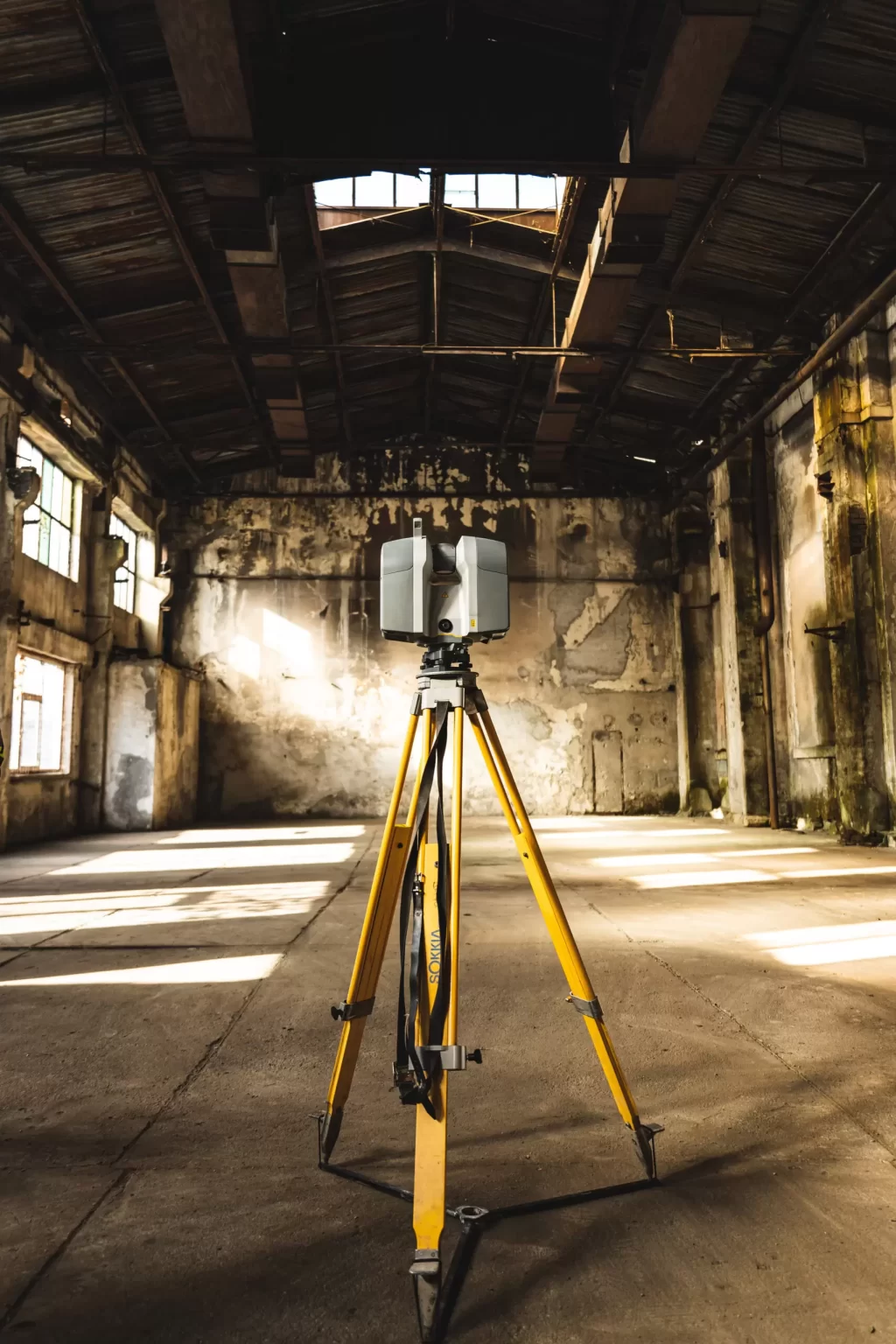
- A performance standard in 3D data collection
- High accuracy throughout the entire scanning range, up to 340m
- 1 million points per second.
Deliverables obtained from scanning
- Point cloud
- 2D plans and elevations, vertical sections
- 3D Model — Mesh & DTM
- 360 panoramic photos
- Facade surveys and site plans
- Volumetric reports of scanned areas
- Orthophoto plane from point cloud
- 3D model — BIM
- 3D Model — BIMTime Monitoring Reports
Areas of use
Deliverables that can be provided following 3D SCANNING
1. Obtain 2D plans/horizontal sections necessary for:
- Useful support in design/redevelopment
- RBOMA students for determining the areas available for rent
- Cadastre and tabulation
2. Obtain vertical sections required for:
- Determining wall thickness
- Highlighting the verticality of structural elements
- Useful editable support for the designer/architect
3. Mesh
- The ideal solution for presenting irregular shapes in a 3D space
- Games/animations/movies
- Detailed representation of certain objects/buildings
4. Obtaining facade plans/surveys required for:
- Redevelopments or renovations (especially in historic monument buildings, where the original architectural form must be respected)
- Calculation for determining surfaces – repair/bidding costs/existing materials
- Highlighting less visible areas affected by degradation
5. Obtaining the 3D model required for:
- Real-time space rearrangement with furniture modification/movement, checking the position of elements that may appear in the future, checking circulation spaces, (re)designing installations
- Creating representative videos for the scanned space
FAQ
How long does it take to 3D laser scan a building?
On-site data collection takes from a few hours for an apartment or a floor, to a few days for large buildings or industrial complexes.
The deadline is confirmed after analyzing the surface area, the complexity of the objective and the level of detail requested.
Do I need to stop activity in the building during the scan?
In many situations, it is not necessary to completely stop the activity. Scanning can be organized in stages, by areas, in offices, factories, shopping centers or hotels that are in operation. However, the scanned spaces must be accessible, and the movement of people or the operation of equipment may be temporarily limited. The work schedule is established together with the beneficiary.
How accurate is 3D laser scanning?
3D laser scanning offers millimeter-level accuracy. As a technical benchmark, manufacturers indicate a 3D point accuracy of 3 mm at a distance of 20 m for Trimble X9 equipment and 2.9 mm at 20 m for Leica RTC360.
These values represent equipment specifications and do not constitute a guaranteed tolerance for any deliverable. The final result depends on the scanning distance, the measured surfaces, environmental conditions, working methodology and data processing method.
What deliverables do I receive after 3D laser scanning?
Deliverables are determined by the scope of the project and may include: 3D point cloud, 360 panoramic photos, orthophoto generated from the point cloud, 2D floor plans, facades, sections, situation plans, 3D BIM, mesh or DTM models, plans for checking flatness and verticality, volumetric reports and monitoring reports.
3D models can be provided in formats such as Revit, IFC, DWG, OBJ or STL. Virtual tour can be included when it is part of the project requirements.
What information do I need to prepare to receive a quote?
To prepare the offer, the address of the objective, the type of construction, the estimated developed area, the number of levels, the areas to be scanned, the purpose of the project and the desired deliverables are useful.
If you request a 3D model, the delivery format and the level of detail must be established: LOD 100, LOD 200 or LOD 300.
What is the difference between 3D laser scanning and photogrammetry?
3D laser scanning directly measures distances using a laser beam and generates a point cloud that describes the geometry of the object. Photogrammetry reconstructs the shape and dimensions of objects or terrain by processing aerial or terrestrial images taken from different angles. From these images, point clouds, orthophotos and 3D digital models can be generated. The methods can be used separately or combined, depending on the area, access, level of detail and required deliverables.
Can 3D laser scanning be used for historical monuments?
Yes. 3D laser scanning allows the documentation of geometry and architectural details without direct contact with the measured surfaces. The data obtained can be used for restoration, conservation, design and digital archiving. Xplorate Group has carried out 3D scanning and modeling projects for Peleș Castle, Bran Castle and Curtea de Argeș Monastery – Episcopal Palace.
What is a BIM model made from 3D laser scanning?
The BIM (Building Information Modeling) model is a 3D model built on the basis of the point cloud, which reproduces the existing geometry and can include descriptive attributes for the modeled elements. Its content is determined by the level of detail required, usually LOD 100, 200 or 300, and by the disciplines included in the project, such as architecture, structure or installations.
Scanning records the visible geometry. Hidden materials and elements are not automatically identified. The process by which the point cloud is transformed into a BIM model is called Scan-to-BIM.
3D scanning projects
Send us a message
Explore the right solution for your project.
Fill out the form and we will analyze your requirements and get back to you with the next steps.