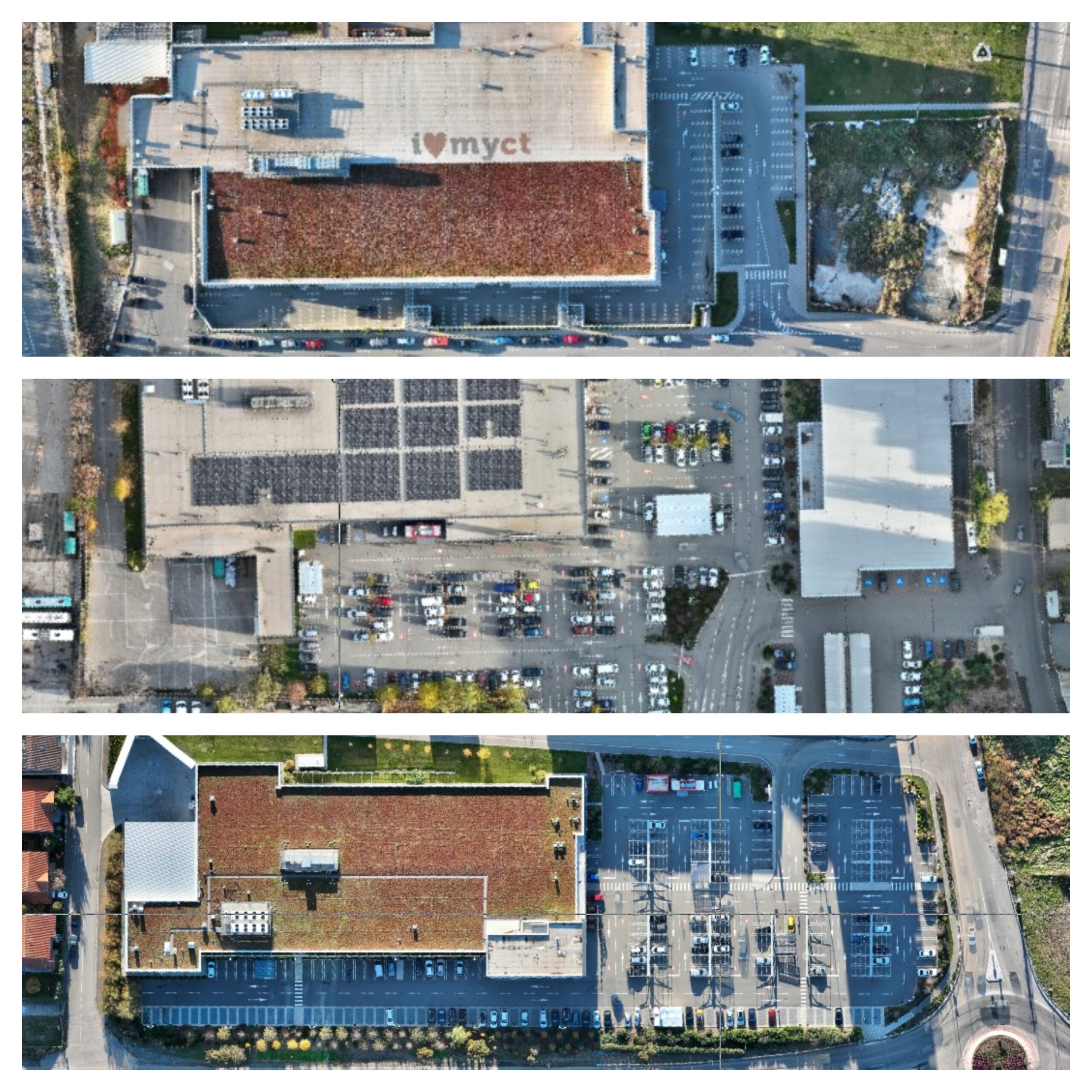
What is an Orthophotoplan?
An orthophotoplan is a metric image created by combining aerial photographs taken by a drone. Unlike a simple stitching of photographs, the orthophotoplan eliminates distortions caused by the photogrammetric camera or the terrain’s relief. It is generated within a well-defined projection system, such as Romania’s national Stereo ’70 projection system.
Below, we will detail how an orthophotoplan is created, its benefits, the fields in which it can be used, the software involved, and the costs associated with its production.
Key characteristics of an orthophotoplan:
- Eliminates errors and distortions, offering remarkable accuracy
- Resolution can be centimetric or even millimetric, depending on project requirements
- Ideal for various fields, including topographic and cartographic studies, hydrotechnical surveys, urban and rural planning, natural resource management, agriculture, infrastructure, and transportation, among others.
How is an orthophotoplan created?
Creating an orthophotoplan requires specific datasets and equipment:
- Aerial photographs: These may or may not include geotags.
- 3D coordinates: Of control points marked on the ground.
- 3D coordinates of camera centers: Determined using PPK (Post-Processed Kinematic) or RTK (Real-Time Kinematic).
Using photogrammetric processing techniques and specialized software, a point cloud is generated, which then serves as the basis for creating the orthophotoplan.
Equipment used:
- Drone: DJI Mavic 3E RTK
- LIDAR system: Rock Robotic R3 PRO, mounted on a DJI Matrice 350 drone
- Graphic workstations: For data processing
Software used for processing
Photogrammetric processing is performed using Pix4D Mapper, one of the most advanced programs available. Engineers involved in this process hold certifications issued by the software producers, ensuring professional-grade results.
Duration and cost:
The time required to create an orthophotoplan depends on:
- The number of aerial photographs taken
- The desired resolution
- The nature and location of the terrain.
For a customized price offer, please feel free to contact us.
What can an orthophotoplan be used for?
An orthophotoplan is an extremely valuable resource in:
- Topography, cartography, and map creation
- Urban and rural planning: Assists in infrastructure planning and development, evaluating territorial changes, and managing land use.
- Agriculture: Enables farmers to monitor crop health and manage resources efficiently.
- Construction and real estate development: Used to assess potential construction sites and manage development projects.
- Natural resource management: Helps in managing forests, water resources, and other natural assets.
- Environment and conservation: Monitors environmental changes and supports the management of protected areas or regions affected by natural disasters.
- Infrastructure and transportation: Facilitates planning and maintenance of roads, railways, and other transport infrastructure.
Additional benefits
In addition to orthophotoplans, we also offer other photogrammetric services, such as:
- 3D Point cloud: Generated through photogrammetry or LIDAR, this is colorized based on aerial photographs and provides highly detailed information about terrain and infrastructure.
- Digital Elevation Models (DEMs) of the measured surface
- Digital Terrain Models (DTMs)
- Virtual tours: 360° panoramic images created with spherical cameras or laser scanners (Leica RTC360, Trimble X9)
- Commercial aerial photography and filming: Products can be delivered with or without post-processing.
Measurement accuracy
The accuracy of photogrammetric reconstructions depends on several factors:
- Quality of the photogrammetric camera
- Flight altitude
- Longitudinal and transversal overlap of the planned flight and the processing software used
- GSD (Ground Sampling Distance)
For example, at a GSD of 5 mm, planimetric accuracy can range between 5 and 10 mm, while altimetric accuracy can vary between 5 and 15 mm.
In conclusion, orthophotoplans are essential tools in the geospatial domain, providing a precise and detailed representation of the terrain. They are widely used in cartography, urban planning, agriculture, natural resource management, and infrastructure projects. By correcting geometric distortions in aerial images, orthophotoplans enable users to make informed decisions based on accurate data, contributing to the efficiency of planning and management processes.
Due to their versatility, orthophotoplans not only facilitate detailed analysis of the environment but also support the sustainable development of communities.
Xplorate Group is ready to offer the best solutions tailored to your needs.
Contact us for further details!


