Lidar
Lidar Scanning, Mobile mapping and SLAM
Lidar Scanning, Mobile mapping and SLAM in the field of surveying
Xplorate Group provides Lidar scanning, mobile mapping and SLAM services. Explore in detail how these technologies work and what their advantages are.
Scanning and mapping technologies have made significant leaps in recent years, bringing innovations that have revolutionized the field of surveying. Lidar technology, mobile mapping and SLAM are fundamental tools that enable the rapid and precise collection of geospatial data.
These technologies have expanded application possibilities and significantly improved the efficiency of mapping and surveying processes. In this article, we will explore in detail how these technologies work and what their advantages are.
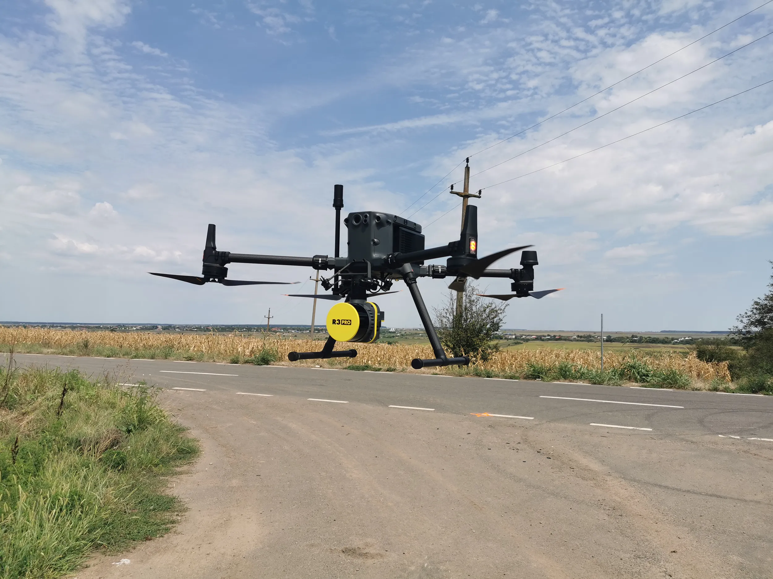
We use an advanced airborne lidar scanning system.
The Rock Robotic R3 PRO, mounted on the DJI Matrice RTK 350 drone. Additionally, we also offer services in the field of 3D laser scanning.
Advantages of lidar technology
- Precision: Lidar provides extremely precise distance measurements, enabling the creation of detailed maps and digital models.
- Speed: Compared to traditional surveying methods, Lidar allows for rapid data collection, saving valuable time during the design and implementation phases.
- Versatility: Lidar can be used in a variety of fields, including surveying, engineering, agriculture, and archaeology.
- Complexity: The ability to obtain detailed three-dimensional models of the environment is essential for complex analyses and customized design solutions.
Lidar vs. terrestrial scanning
- Mobility: Mobile Lidar allows for the rapid coverage of extensive areas, while fixed scans require multiple setups and frequent relocation of equipment. This makes mobile Lidar ideal for large-scale projects.
- Ease of use: Fixed scanning can offer greater precision in certain critical conditions, but the mobility and flexibility of mobile Lidar make it more practical for a wide range of applications.
- Cost: Fixed scanning often involves higher costs and more time for setup and data collection. In contrast, mobile technologies, including SLAM, can significantly reduce the time and costs required for field data collection.
What is lidar technology?
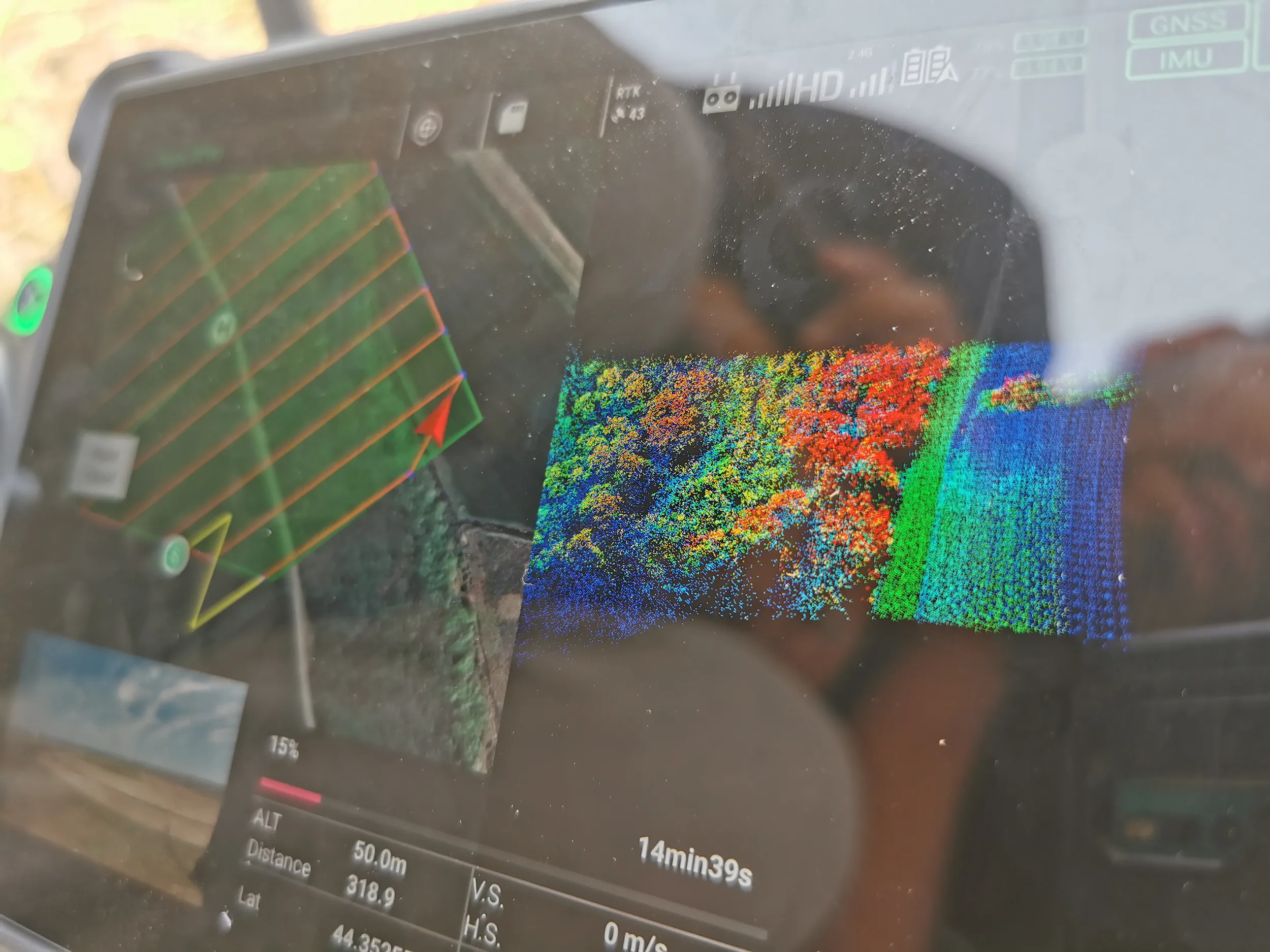
Lidar technology, short for “Light Detection and Ranging” is a measurement system that uses light in the form of a laser to measure distances. A Lidar sensor emits light pulses towards a surface and measures the time it takes for them to reflect back to the receiver. This technology produces a series of precise measurements, generating a “point cloud” that represents the surveyed surface. Transformed into a three-dimensional model, these points provide detailed “images” of the terrain and objects analyzed.
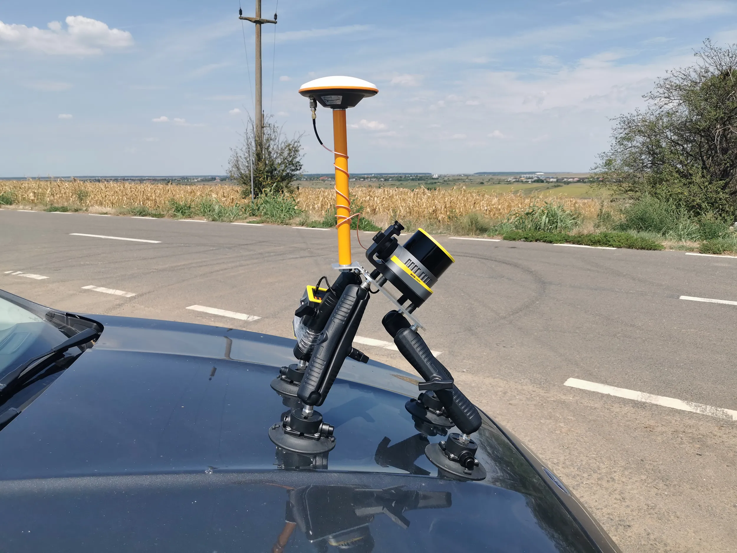
What is Mobile Mapping?
Mobile mapping is the process of collecting geospatial data using vehicles equipped with advanced sensors, including Lidar, cameras, and GPS. These vehicles, which can be cars, drones or other mobile platforms, navigate through extensive areas, collecting data quickly and efficiently. The results are used for urban mapping, road infrastructure planning, and various other surveying applications.
One of the major advantages of mobile mapping is its ability to collect geospatial data in a coherent and integrated manner, significantly reducing the time required for subsequent processing and analysis. This method is ideal for large-scale projects where field data needs to be collected quickly and accurately.
What is SLAM?
SLAM, or Simultaneous Localization and Mapping, is an advanced technology that enables a device to determine its precise position in an unknown space while simultaneously creating a map of that space. This technology is crucial for autonomous vehicles, drones, and robots operating in dynamic or unexplored environments.
SLAM combines motion sensors with visual and LIDAR measurements to calculate the device’s position in real-time and construct a map of the surrounding environment. This allows vehicles and robots to navigate safely and efficiently, avoiding obstacles and adapting to environmental changes.
Lidar Scanning
Lidar scanning, using specialized sensors, involves emitting laser pulses and measuring their return time to collect precise data about topography and structures. Platforms used for Lidar scanning include drones, ground vehicles, and even satellites. Each type of platform offers distinct advantages: drones provide flexibility and access to inaccessible areas, while ground vehicles are ideal for detailed ground scans.
The collected data is analyzed and processed to create three-dimensional digital models, which are used in infrastructure project design and planning, environmental studies, and cultural heritage protection.
Modern technologies such as Lidar, mobile mapping and SLAM have brought significant improvements to the field of surveying. Offering speed and versatility, these technologies have transformed how we collect and analyze geospatial data, facilitating infrastructure projects, cultural heritage conservation, and innovations in autonomous vehicles. Integrating these technologies into current surveying practices not only optimizes processes but also opens new opportunities in various fields of activity.