
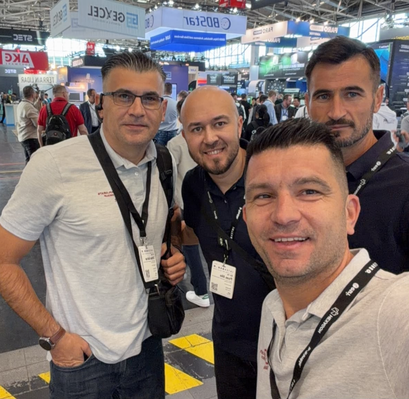

Between September 15 and 17, the Xplorate Group team attended INTERGEO 2026 at Messe München, one of the leading international events dedicated to geodesy and geospatial technologies.
We went to Munich to follow the developments that may directly influence projects involving engineering surveying, 3D laser scanning, LiDAR, mobile mapping, photogrammetry, BIM, cadastre and monitoring the behaviour of structures over time.
INTERGEO 2026 brought together more than 530 exhibitors and professionals from over 100 countries. Beyond the large number of equipment and solutions presented, one direction stood out: sensors, software, processing and data delivery are increasingly operating within the same ecosystem.
We selected five technologies that caught our attention.
1. Trimble ST30: the prism becomes an intelligent measurement system
Trimble ST30 Smart Target brings several functions together in a single device: a 360° prism, IMU, GNSS receiver and automatic pole height measurement.
The system provides tilt compensation for both optical and GNSS measurements and uses active target identification. On sites where several teams or multiple prisms are operating in the same area, this feature can reduce the risk of the total station tracking the wrong target.
For us, ST30 is particularly relevant for construction surveying support, setting-out, As-Built measurements and infrastructure projects.
Compatibility with Trimble S, RTS and SPS series total stations, together with Trimble Access and Trimble Business Center, allows ST30 to be integrated into surveying workflows we already use.
2. Leica GS11 and the X-PAD ecosystem
Leica Geosystems presented the Leica GS11 GNSS Smart Antenna, together with the Leica X-PAD portfolio.
GS11 introduces features such as augmented reality guidance and image-based measurement. Operators can visually identify points, verify collected information while still in the field and determine points from images, including locations that are difficult to reach directly with a survey pole.
For Xplorate Group, the connection between the sensor, software and project data is particularly relevant.
The integration of X-PAD into the Leica ecosystem shows where the market is heading: fewer isolated stages and a more connected workflow.
3. RIEGL miniVUX-4UAV and miniVZ-500: compact LiDAR for specialised applications
RIEGL came to Munich with miniVUX-4UAV and miniVZ-500.
miniVUX-4UAV expands the range of LiDAR sensors designed for UAV platforms. miniVZ-500 is a compact scanner developed for applications including continuous monitoring and industrial environments.
Weighing 3.6 kg, with a 360° horizontal and 80° vertical field of view and IP66/IP67 protection, miniVZ-500 can also be integrated into permanent installations.
The direction worth following here is the miniaturisation of sensors and their adaptation to increasingly specialised applications. Infrastructure monitoring, automated measurements and LiDAR integration on UAVs or mobile platforms are gaining additional options.
4. NavVis CLX: reality capture becomes part of everyday workflows
NavVis CLX was introduced to the public at INTERGEO 2026 as a handheld system based on a dual-LiDAR architecture.
The product complements the NavVis MLX and VLX range and expands the use of reality capture in projects where acquisition speed and repeat measurements matter.
Integration with IVION Processing and IVION connects data capture, processing and use within a single workflow.
Mobile scanning is becoming increasingly specialised. Equipment can be selected according to project requirements, the required level of detail and the available time.
5. Topcon Origo: a different approach to indoor setting-out
Topcon Origo introduces a different method for setting-out inside buildings.
The system uses spatial reference maps and a fixed origin to maintain positioning within the project. The scanner and controller are integrated into a mobile pole-mounted system.
For Xplorate projects involving BIM, MEP, Scan-to-BIM and construction surveying support, Origo is a technology worth following. SLAM, spatial positioning and digital models are increasingly entering activities traditionally associated with the total station.
What we brought back from INTERGEO 2026
After three days in Munich, the direction of the industry was easy to see: sensors are becoming more connected, processing is increasingly automated, and the time between measurement and final deliverable is shrinking.
GNSS, robotic total stations, 3D laser scanning, SLAM, airborne LiDAR, photogrammetry, GIS and BIM are increasingly working as parts of the same digital workflow.
Three directions appeared consistently across the solutions presented: sensor fusion, processing automation and connected Field-to-Office-to-Cloud workflows. At the same time, artificial intelligence is playing a growing role in point cloud classification, object identification and the preparation of CAD, GIS and BIM deliverables.
For Xplorate Group, the three days spent in Munich meant direct access to new technologies, discussions with manufacturers and useful reference points for future investments.
We assess technologies using one simple criterion: what they can bring to our projects and clients in the field, during processing and in the final deliverable.
Xplorate Group | Truly Xploring the world.