
Xplorate Group is a company active in the field of topographic and geodetic services and 3D laser scanning, providing solutions for real estate, infrastructure, construction, architecture and restoration projects.
Choosing a partner for topographic and geodetic services usually starts with recommendations within professional networks, continues with immediate availability and is confirmed through complete, accurate deliverables provided on time. A reliable partner offers applied solutions, understands the regulatory framework and provides technical guidance from the very first day. When constant verification or correction of other parties’ work is required, time loss quickly turns into profit loss.
Xplorate Group works with partners who value speed, transparency and trust at every stage of a project. The key differentiator lies in integrated services that ensure consistency and synchronized deliverables. Partner relationships are built on close collaboration, a clear understanding of project needs and a strong focus on outcomes.
Xplorate Group’s services stand out through an integrated approach that covers all project phases: 3D laser scanning, 3D modeling, photogrammetry, measurements for long term structural monitoring, including settlement and crack monitoring, apartment subdivision surveys, on site topographic assistance, AACR approvals and area calculations in accordance with the BOMA standard.
These datasets can be used directly by architecture, engineering or property management teams, reducing redundant steps and the time lost reinterpreting information.
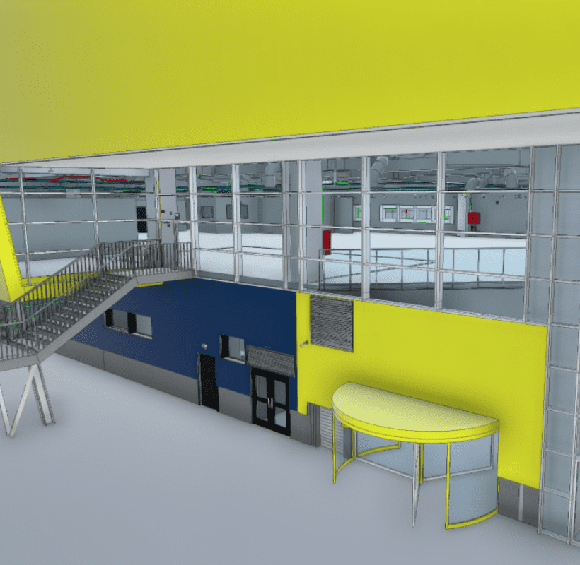
3D laser scanning is increasingly used by developers and architects, as it provides a comprehensive view of any structure, building, land parcel or monument within a short timeframe. The result is a point cloud, a detailed digital representation of the scanned surfaces.
3D modeling transforms this data into a three dimensional digital model that can be used in architectural and design applications. Integrating 3D scanning and modeling into architectural practice improves project quality and opens new opportunities in design, restoration and construction.
The 3D models can be integrated directly into applications such as ArchiCAD, Revit or Rhino. They provide a complete overview, including hard to access areas, and allow analysis of geometry, positioning, thickness and potential structural degradation.
For designers and developers, this translates into project control from the design phase through execution and verification, through the delivery of 3D models, 2D drawings and real time updated As Built documentation.
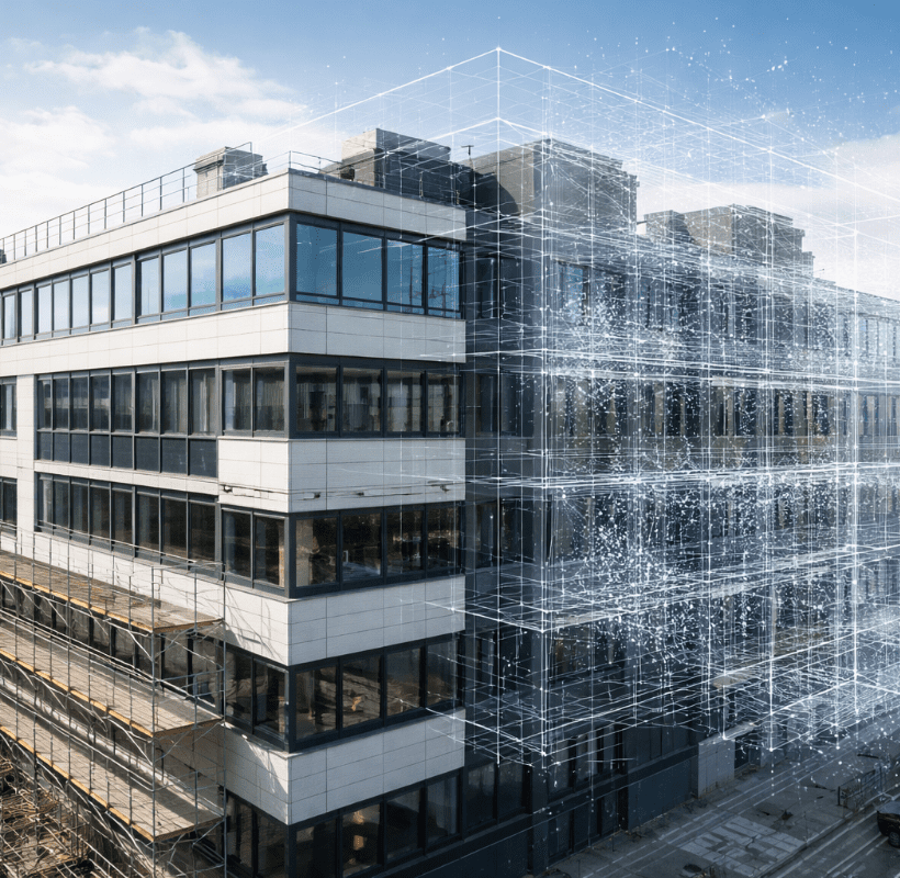
In the design and construction sector, technology plays a critical role. 3D scanning enables the capture of geospatial data for industrial and civil buildings, as well as historical monuments, using technologies such as terrestrial and airborne LiDAR, mobile mapping and SLAM, providing a solid foundation for long term decision making.
From traditional topography to integrated solutions
Topography has evolved significantly over recent decades, moving beyond basic measurements and plans. We continuously invest in 3D scanning technologies, drones and automated processing software in order to deliver data quickly and accurately. This approach gives clients the confidence that their projects can progress without technical bottlenecks or errors.
3D scanning supports the design and execution process by providing detailed digital information that can be easily integrated into BIM workflows or specialized analyses.
Sustainable construction and smart buildings
The digitalization of construction brings tangible changes: smarter buildings, better cost control and predictable maintenance.
3D modeling is the foundation of the digital twin concept, simulations that reflect building behavior and enable resource monitoring and rapid intervention in utility systems. For beneficiaries, this means easy access to continuously updated data that supports long term planning and space management.
As the market increasingly demands sustainable buildings and smarter cities, Xplorate’s services focus on digitalization and the integration of data into long term construction management. 3D laser scanning, combined with BIM models and energy analysis, supports monitoring of consumption, maintenance and cost optimization.
These benefits are reflected across all Xplorate Group projects, where 3D laser scanning technology is used for residential and commercial buildings, as well as heritage monuments, delivering digital models and documentation that provide full control and visible results.
Xplorate Group has implemented these solutions in residential, commercial and heritage projects. Reference collaborations include Romexpo, Ikea, Bran Castle, Sky Tower, Peleș Castle, Akcent City, the A0 Motorway, WDP Romania, Stejarii Country Club, Novum Invest, Confort Urban, Dream Residence, Tower Residence, CRC Investment and Cortina North.
Xplorate Group remains a trusted partner for companies that require integrated solutions for real estate, infrastructure, green energy, logistics spaces and urban rehabilitation projects. Technology does not replace human experience, it complements it.
If you are working on a project that requires accurate deliverables and cost free technical consultancy, tell us more about it. We help you choose the right services and understand how they can be applied to your project.