Matterport Virtual tour – ultra-realistic 3D scanning for buildings and complex spaces
A Matterport virtual tour is the complete capture of a space and its transformation into a navigable 3D model. The model becomes a faithful digital representation of reality and can be used in analysis, presentation or technical coordination.
It is suitable for office buildings, residential, retail, HoReCa, industrial spaces or projects with complex compartments.
What is Matterport and what differentiates it from a classic virtual tour?
Matterport is a 3D scanning technology that creates a complete spatial model, not just a sequence of panoramic images.
A classic 360° virtual tour offers fixed stop points. The user changes frames.
Matterport generates a continuous three-dimensional model. The user moves naturally through the space, with a real perception of volume.
The result is a “digital twin” of the building, usable both commercially and technically.
By capturing point clouds and 360° panoramic images and processing them in the cloud, a “digital twin” of the real space is created. The model allows:
- free navigation in the 3D mesh model (dollhouse)
- free navigation in first person view inside and outside
- augmented navigation (defurnish) through an AI engine it is possible to visualize the visualization of the space excluding personal objects and existing furniture
- direct measurements in the model
- specification of the space for defining the component rooms and calculating the main distances and surfaces.
virtual reality visualization (necesită ochelari specifici)
Benefits of the Matterport virtual tour
1. Digital twin of the space
Navigable 3D model, with real volume structure.
2. Measurements in the model
Indicative distances can be extracted directly from the platform.
3. Clarity in decision-makin
Investors, tenants or technical teams can analyze the space without traveling.
4. Integration into technical flows
The model can be used in coordination meetings, in design phases or in building management.
5. Reduction of interpretation errors
All participants see the same space, from the same angles.
The work process
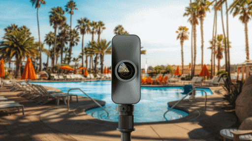
We use Matterport Pro3, a 3D camera with LiDAR sensor dedicated to documenting complex buildings. It allows the capture of large spaces, including halls and buildings with wide openings, with a scan time of less than 20 seconds per position.
The LiDAR sensor records millions of points with each capture and generates a dense point cloud, usable in BIM workflows or in software such as Autodesk. The result is a faithful rendering of volumes and details relevant for technical analysis.
From scanning to final delivery.
- Goal setting
We define the purpose: sale, rental, technical documentation, digital archiving. - On-site scanning
We capture the entire space with dedicated Matterport equipment. - Data processing
The model is generated in the platform and verified internally. - Configuration and customization
We add informative points, labels, links or bookmarks.
5. Delivery
You receive a secure link, easy to integrate on your website or in presentations.
Matterport project examples
- office buildings for promotion and rental
- Retail spaces for layout validation and tenant negotiations
- Restaurants and HoReCa chains for investor presentation
- Industrial spaces for remote technical audit
- Existing buildings documented before renovation
The application is practical. Reduces repeat visits and shortens the decision cycle.


Matterport vs. 360° virtual tour
| Criteria | Matterport | 360° Virtual Tour |
| Model Type | Full 3D Model | Individual Panoramas |
| Volume Perception | Real, 3D | Limited to Frames |
| Measurements | Available in Platform | No |
| Dollhouse Visualization | Yes | No |
| Technical Use | Yes, in Marketing, Coordination, and Analysis | Primarily Marketing |
| Level of Detail | High | Medium |
Frequently Asked Questions (FAQ)
How long does it take to scan a space?
It depends on the area and complexity. An average space can be scanned in a few hours.
How long does it take to deliver the model?
Typically within 1–3 business days after the scan.
Can access to the tour be protected?
Yes. A password or restricted access can be set.
Is it suitable for large buildings?
Yes. The technology allows for the capture of large spaces, including multiple levels.
Can it be integrated into the website?
Yes. The model can be integrated directly via embed.
Can 2D plans be extracted?
Additional deliverables can be generated upon request.
Proiecte verificări imbile
- Asistență topografică în șantier, UCC, rapoarte de monitorizare a deformatiilor 3D, măsurători As Built
- Construction behavior tracking in time.
- 3D laser scanning and 2D drawings, Scan- to-BIM
- Survey engineering, measurements for monitoring the behavior of neighboring constructions over time, earthwork volume calculation, 3D monitoring of capping beams
- Photogrammetry, Survey engineering during the execution phase, Site plans for design purposes
- 3D laser scanning , Virtual tour, 3D Solid model (Revit)
- Survey engineering for the designed elements, land registration and division into apartments, topographical survey.
- Topographic survey, 3D laser scanning, interior mapping according to BOMA standard, land registration, topographic elevation and planimetric survey, altimetric and planimetric survey.
- Residence topographic survey, 3D scanning, division into apartments, survey engineering
Request a quote for a Matterport virtual tour
Tell us what space you want us to document.
We propose a scanning plan and delivery time adapted to your project.
To obtain information about virtual tours, requests for quotes, contact us:
Alin Pisău
Technical Director