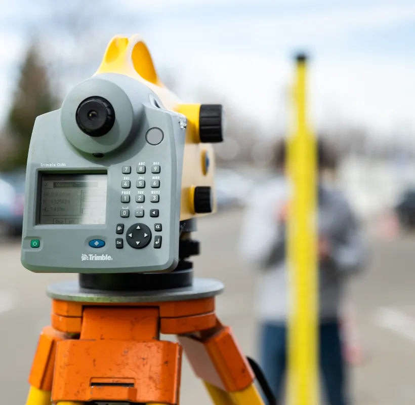
Construction behavior tracking in time
Monitoring settlements, displacements, cracks and vibration monitoring (both for the construction in progress and neighboring constructions)
It represents an extensive examination process to detect degradations that can lead to a decrease in the ability to operate the constructions in optimal safety conditions.
What are the benefits of these measurements:
- prevention of incidents, accidents
- full perspective on possible settlements/inclinations of the entire project
- damage reduction
- preventing negative impact on neighboring constructions
Some of the stages completed within this type of project:
- installation of settlement markers/planimetric landmarks in order to track the settlements/displacements of the newly executed construction and/or neighboring constructions
- carrying out measurements specific to monitoring projects using the most precise topographical techniques and equipment
- the rigorous processing of measurements by the smallest squares method in order to deduce the most probable values of the settlements/displacements as well as the standard deviations determined
- drawing up the monitoring report that will include tables with the settlements/displacements of mobile landmarks as well as graphics/diagrams offered on analogue and digital media
In terms of the investigations carried out, we distinguish:
Special monitoring
Special monitoring consists of regular and periodic investigations with regard to the specific parameters that characterize a construction or certain parts of it. These parameters are established since the design phase or following a technical expertise. The special tracking is carried out for a specific period, according to a project or a well-defined procedure (design theme), by specialized and certified technical personnel.
Current monitoring
Current tracking of constructions is done using direct visual monitoring techniques and simple measurement tools. These activities can be carried out both by owners, natural persons with technical training in construction, as well as by companies specialized in tracking the behavior of constructions over time.
Following the measurements, we provide a detailed report that includes a photographic survey, the location and description of the building, conclusions and recommendations.
As for the methods used to track the evolution of buildings and land over time, they can be divided into two main categories:
Physical methods: These methods involve placing measuring devices directly on or inside the investigated construction. The devices move with the construction, and relative displacements are generally measured by these methods.
Geometric (geodesic) methods: In this case, reference is made to the position of certain fixed points on the construction and refers to fixed points placed outside the area of influence of the factors affecting the constructions and the land on which they are located. These methods determine vertical, horizontal or spatial displacements in both absolute and relative terms
Special monitoring is divided into the following categories:
- Cracks monitoring
- Settlements monitoring
- Displacements / plane deformations monitoring
- Displacements / spatial deformations monitoring

Vibration Monitoring – a key component of monitoring
Xplorate Group provides construction behavior tracking services, including vibration monitoring, an essential factor in preventing structural damage and ensuring safety.
Why is vibration monitoring important?
Vibrations caused by construction activities, heavy traffic, industrial machinery, or even natural conditions can impact infrastructure stability, including buildings. If not properly monitored, these vibrations can lead to cracks in structural elements, weakened foundations, or other long-term structural issues.
Benefits
✔ Early risk detection
✔ Prevention of structural degradation
✔ Compliance with regulations
✔ Safety for neighboring buildings
How vibration monitoring is conducted
- In order to carry out vibration monitoring for the targeted structures, specialized measurements will be conducted to determine their inherent modal dynamic characteristics, exemplified by natural frequencies and damping ratios.
- Additionally, the maximum displacement amplitude during vibration is measured, with results represented in three dimensions (longitudinal, transverse, and vertical directions relative to the monitored structure).
- Sensors are installed at critical points, and measurement equipment is positioned to accurately capture vibration propagation. The real-time collected data enables analysis and interpretation of the impact on the structure.
- The collected data is used to generate reports that include tailored solutions for mitigating risks and enhancing the structural safety of the monitored building.
- Whether is used for residential buildings, industrial structures or historical monuments, vibration monitoring plays a crucial role in maintaining structural integrity, avoiding costly repairs and ensuring the safe operation of monitored facilities.
Projects
- Asistență topografică în șantier, UCC, rapoarte de monitorizare a deformatiilor 3D, măsurători As Built
- Construction behavior tracking in time.
- Survey engineering, measurements for monitoring the behavior of neighboring constructions over time, earthwork volume calculation, 3D monitoring of capping beams
- Interior mapping according to BOMA standards, construction behavior tracking in time, topographic survey, topographic assistance on site
- Floor plans and facades for determining verticality, georeferencing, construction behavior tracking in time
- Construction behavior tracking in time of the executed and neighboring constructions, land and construction registration, documentation to declare subdivision into flats, land dismantling
- On site topographic assistance ,construction behavior tracking in time.
- Interior measurements 60,000 sqm and calculation of rentable areas according to BOMA standard
- Topography survey , execution support , construction behavior tracking in time, land registry .
- 11 buildings G+11S. Resistance structure is monolith C30/C37 armored concrete, foundation is 85 cm thick with two-level basements and 30 cm thick walls.
- Topographic survey for design, topographic assistance on site, construction behavior tracking in time, land registry, updating, construction registration, individual units.
- Topography survey, execution support, construction behavior tracking in time, land registry.
- Topographic assistance on site - execution, Construction behavior tracking in time of the executed construction and the neighboring ones.
- 3B+G+23S. Total surface of 69.000 square meters. The first LEED Platinum certified building. Total office space: 60.000 square meters.
- Topographic surveying for design, Topographic assistance on site – execution, Monitoring
Send us a message
Contact a land surveying specialist
Alin Pisău
Technical Director

